2023 Map of West Mansfield
USGS Topo · Published 2023About this map
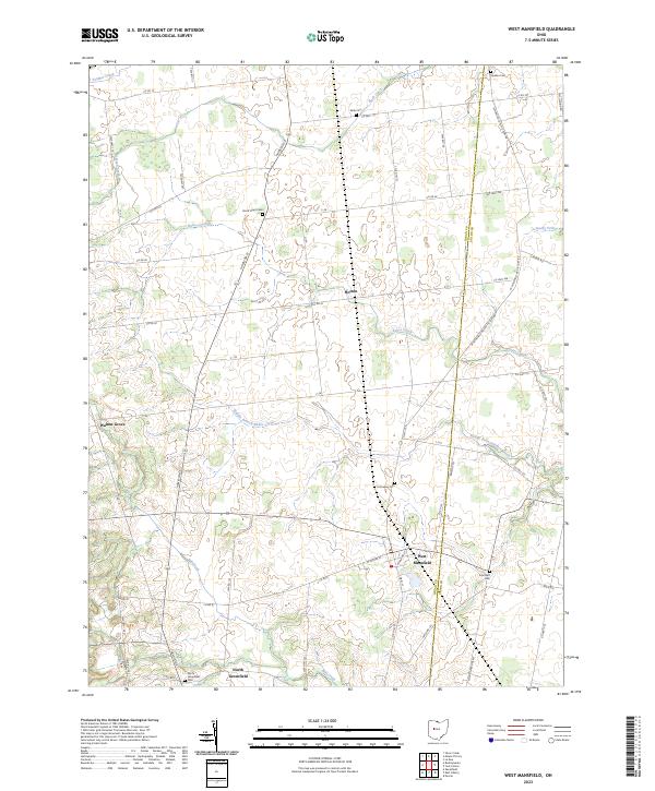
West Mansfield serves as a primary hub for this agricultural portion of Central Ohio, situated along the Logan and Union county line. The landscape is defined by a dense network of watercourses including Bokes Creek, Middle Branch Bokes Creek, and Mill Creek, which wind through the rural terrain. This region preserves significant genealogical evidence through its numerous burial grounds, such as Quaker Cem and Good Hope Cem, reflecting a history of diverse settler communities. Small hamlets and crossroads like Walnut Grove, Horton, and North Greenfield remain connected by an extensive grid of township and county roads. The mapping of these minor settlements alongside rural landmarks like Early Cem provides a clear view of the area's enduring rural character and the persistence of early land divisions.
Find a feature on this map
60 named features on this map. Tap any name to fly to it.
Don’t see what you’re looking for? This feature index may not catch every label — zoom into the map to look around manually.
Map Details
Editions of this 2023 West Mansfield Map
This is the sole edition of this map. No revisions or reprints were ever made.