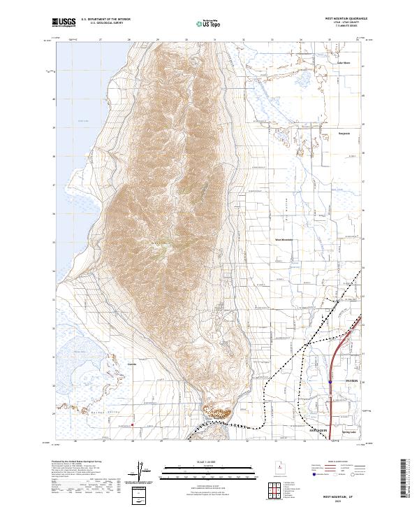
2023 Map of West Mountain
USGS Topo · Published 2023About this map
West Mtn dominates the center of this landscape, rising sharply between the southern shores of Utah Lake and the agricultural expanses of the Goshen Valley. This high-elevation ridge creates a distinct natural boundary between the water-front communities of Lake Shore and the inland settlements of Genola and Keigley. The map reveals a complex irrigation and water management network, featuring the Benjamin Slough, South Ditch, and Tanner Reservoir, which have long supported the local farming economy near Benjamin. To the south, the terrain transitions at the Goshen Gap, where the foothills meet the rising elevations of Long Ridge. The proximity of Payson and Santaquin illustrates the historical clustering of towns along the base of the mountains where mountain runoff and perennial sources like Holladay Springs provided reliable water.
Find a feature on this map
65 named features on this map. Tap any name to fly to it.
Don’t see what you’re looking for? This feature index may not catch every label — zoom into the map to look around manually.
Map Details
Editions of this 2023 West Mountain Map
This is the sole edition of this map. No revisions or reprints were ever made.
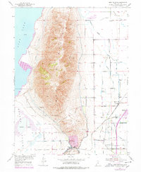
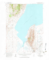
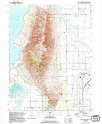
Historical Maps of Keigley Through Time
4 maps found