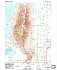
1994 Map of West Mountain
USGS Topo · Published 1994About this map
West Mountain rises sharply as a prominent landform between the southern shores of Utah Lake and the agricultural expanses of Goshen Valley. The landscape is defined by its industrial and hydraulic infrastructure, most notably the massive Keigley Quarry at the southern tip near Goshen Gap. This area serves as a critical corridor for water management and transport, featuring the Strawberry High Line Canal and the Utah Aqueduct skirting the mountain's base.
Find a feature on this map
27 named features on this map. Tap any name to fly to it.
Don’t see what you’re looking for? This feature index may not catch every label — zoom into the map to look around manually.
Map Details
Editions of this 1994 West Mountain Map
This is the sole edition of this map. No revisions or reprints were ever made.
Other maps of this area

1885 · Salt Lake
USGS Topo · 1:250,000

1885 · Manti
USGS Topo · 1:250,000

1895 · Manti
USGS Topo · 1:250,000

1948 · Spanish Fork
USGS Topo · 1:24,000

1948 · Provo
USGS Topo · 1:24,000

1949 · Provo
USGS Topo · 1:62,500

1950 · Provo
USGS Topo · 1:24,000

1950 · Spanish Fork
USGS Topo · 1:24,000

1950 · West Mountain
USGS Topo · 1:24,000
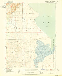
1950 · Goshen Valley North
USGS Topo · 1:24,000