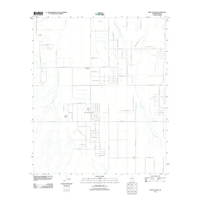
2011 Map of West of Avra
USGS Topo · Published 2011About this map
Agricultural and aviation interests define this desert landscape in Pima County. The influence of the cotton industry is evident at the Western Avra Cotton Gin and the Avra Cotton Gin, which serve as local anchors for the surrounding grid of rural roads. This area is a hub for specialized aviation, featuring Palm Valley Tucson Airport, Taylor Field, and the uniquely named The Ultralight Strip. These small airfields are carved out among the desert flora, including regions marked by N Mesquite Oasis Ln. The terrain is characterized by the wide, braided drainages of Blanco Wash and Brawley Wash, which cut through the territory from north to south. A network of trails and named lanes like N Maggies Farm Ln and N Ghost Ranch Trl suggests a mix of ranching operations and desert residences integrated into the basin landscape.
Find a feature on this map
62 named features on this map. Tap any name to fly to it.
Don’t see what you’re looking for? This feature index may not catch every label — zoom into the map to look around manually.
Map Details
Editions of this 2011 West of Avra Map
This is the sole edition of this map. No revisions or reprints were ever made.
Other maps of this area

1925 · San Xavier
USGS Topo · 1:62,500

1934 · Tucson Mountains
USGS Topo · 1:125,000

1941 · Cocoraque Butte
USGS Topo · 1:62,500

1943 · Cocoraque Butte
USGS Topo · 1:62,500

1943 · San Xavier Mission
USGS Topo · 1:62,500

1947 · Cortaro
USGS Topo · 1:62,500

1956 · Tucson
USGS Topo · 1:250,000

1957 · San Xavier Mission
USGS Topo · 1:62,500

1957 · Cortaro
USGS Topo · 1:62,500

1958 · Tucson
USGS Topo · 1:250,000