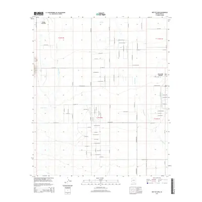
2014 Map of West of Avra
USGS Topo · Published 2014About this map
Picture Rocks and the western reaches of the Avra Valley define this landscape on the edge of the Tucson basin. The terrain is characterized by a network of ephemeral watercourses including Blanco Wash, Brawley Wash, and China Draw, which dictate the local topography and drainage patterns. A significant modern infrastructure feature, the Central Arizona Project Aqueduct, cuts across the eastern portion of the map, illustrating the critical water management systems required in this desert environment. Small-scale aviation and agricultural heritage are represented by Taylor Field, while family and ranching history is evidenced by specific road names such as W Garcia Ranch Rd and W Yankee Ranch Rd. The map also captures several local landmarks like BK Tank and the small residential footprint of Avra Valley.
Find a feature on this map
74 named features on this map. Tap any name to fly to it.
Don’t see what you’re looking for? This feature index may not catch every label — zoom into the map to look around manually.
Map Details
Editions of this 2014 West of Avra Map
This is the sole edition of this map. No revisions or reprints were ever made.
Other maps of this area

1925 · San Xavier
USGS Topo · 1:62,500

1934 · Tucson Mountains
USGS Topo · 1:125,000

1941 · Cocoraque Butte
USGS Topo · 1:62,500

1943 · Cocoraque Butte
USGS Topo · 1:62,500

1943 · San Xavier Mission
USGS Topo · 1:62,500

1947 · Cortaro
USGS Topo · 1:62,500

1956 · Tucson
USGS Topo · 1:250,000

1957 · San Xavier Mission
USGS Topo · 1:62,500

1957 · Cortaro
USGS Topo · 1:62,500

1958 · Tucson
USGS Topo · 1:250,000