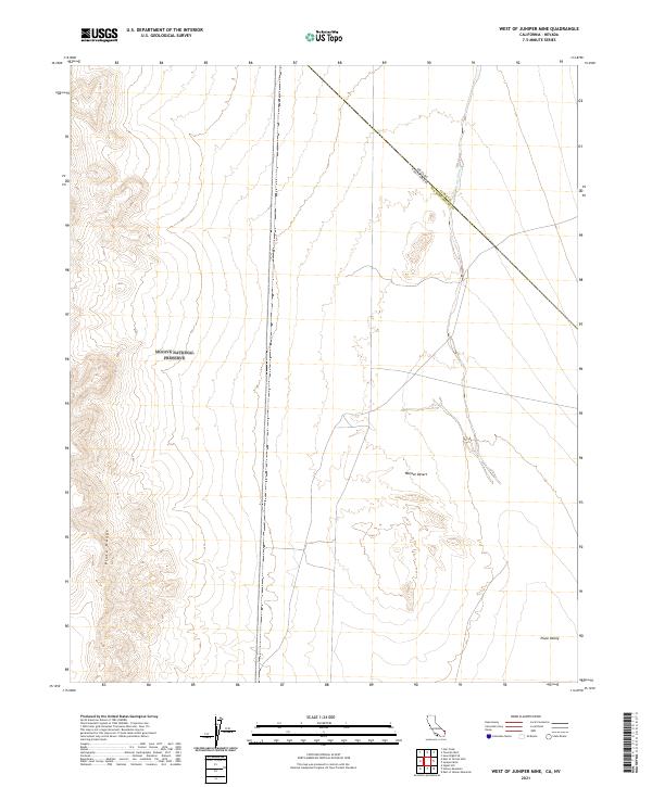
2021 Map of West of Juniper Mine
USGS Topo · Published 2021About this map
The Mojave National Preserve anchors the western portion of this landscape, where the elevations of the Piute Range descend toward the arid flats. This 2021 survey details a remote section of the California-Nevada border, where San Bernardino Co meets Clark Co. The terrain is defined by the broad drainage of the Piute Wash, which flows through the eastern half of the quadrangle toward the Piute Valley. The map illustrates a strictly desert environment within the Mojave Desert, characterized by complex topography and the absence of established modern settlements. The straight-line boundary between California and Nevada cuts diagonally across the northern section, marking a distinct political division in this high-desert corridor.
Find a feature on this map
15 named features on this map. Tap any name to fly to it.
Don’t see what you’re looking for? This feature index may not catch every label — zoom into the map to look around manually.
Map Details
Editions of this 2021 West of Juniper Mine Map
This is the sole edition of this map. No revisions or reprints were ever made.
Other maps of this area

1886 · Camp Mohave
USGS Topo · 1:250,000

1892 · Camp Mohave
USGS Topo · 1:250,000

1910 · Ivanpah
USGS Topo · 1:250,000

1912 · Ivanpah
USGS Topo · 1:250,000

1926 · Mohave City
USGS Topo · 1:96,000

1942 · Camp Mohave
USGS Topo · 1:250,000

1942 · Ivanpah
USGS Topo · 1:250,000

1947 · Kingman
USGS Topo · 1:250,000

1948 · Kingman
USGS Topo · 1:250,000

1954 · Kingman
USGS Topo · 1:250,000