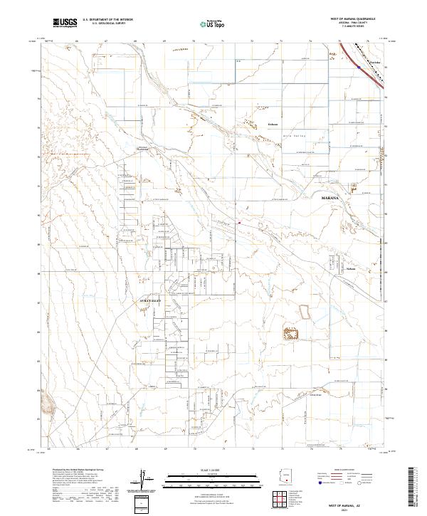
2021 Map of West of Marana
USGS Topo · Published 2021About this map
The Santa Cruz River and its complex network of ephemeral drainages dominate this landscape, illustrating the critical role of water management in the Sonoran Desert. The town of Marana sits near the river's path, supported by local infrastructure like the W Treatment Plant Rd. Surrounding the central valley are smaller residential pockets and historical naming points such as Dobson, Nelson, and Naviska. The land is heavily partitioned by an extensive grid of local roads, reflecting the steady expansion of the Avra Valley community. This area serves as a significant drainage basin where Los Robles Wash, Blanco Wash, and Cocio Wash converge, creating a unique hydrological pattern. The presence of China Draw further emphasizes the varied desert terrain that has shaped settlement and transit through Pima County.
Find a feature on this map
99 named features on this map. Tap any name to fly to it.
Don’t see what you’re looking for? This feature index may not catch every label — zoom into the map to look around manually.
Map Details
Editions of this 2021 West of Marana Map
This is the sole edition of this map. No revisions or reprints were ever made.
Other maps of this area

1934 · Tucson Mountains
USGS Topo · 1:125,000

1934 · Newman Peak
USGS Topo · 1:125,000

1947 · Cortaro
USGS Topo · 1:62,500

1947 · Red Rock
USGS Topo · 1:62,500

1956 · Tucson
USGS Topo · 1:250,000

1957 · Cortaro
USGS Topo · 1:62,500

1958 · Tucson
USGS Topo · 1:250,000

1959 · Tucson
USGS Topo · 1:250,000

1959 · Tortolita Mts
USGS Topo · 1:62,500
1959 · Silver Bell Peak
USGS Topo · 1:62,500