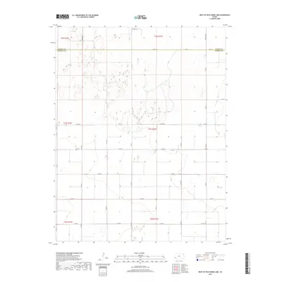
2018 Map of West of Wild Horse Lake
USGS Topo · Published 2018About this map
The jurisdictional boundary between Finney Co and Haskell Co divides this rural Kansas landscape, where the High Plains terrain is organized by an extensive grid of section lines and county roads. The northern portion of the map is dominated by the sandy, rolling topography characteristic of the area west of Wild Horse Lake, with significant north-south corridors like S Sandhill Rd and S Ivanhoe Rd providing access across the dunes. The agricultural layout is strictly defined by the Public Land Survey System, as seen in the intersections of Co Rd 10 and Co Rd LL. While the region appears sparsely populated with few named settlements, the dense network of numbered routes such as Co Rd 50 and Co Rd 80 illustrates the late 20th-century development of the local ranching and farming infrastructure within the township and range divisions.
Find a feature on this map
25 named features on this map. Tap any name to fly to it.
Don’t see what you’re looking for? This feature index may not catch every label — zoom into the map to look around manually.
Map Details
Editions of this 2018 West of Wild Horse Lake Map
This is the sole edition of this map. No revisions or reprints were ever made.
Other maps of this area

1891 · Larned
USGS Topo · 1:125,000

1896 · Garden
USGS Topo · 1:125,000

1900 · Lakin
USGS Topo · 1:125,000

1955 · Dodge City
USGS Topo · 1:250,000

1958 · Dodge City
USGS Topo · 1:250,000

1959 · Dodge City
USGS Topo · 1:250,000

1959 · Garden City 3 NW
USGS Topo · 1:24,000

1959 · Hickok NE
USGS Topo · 1:24,000

1959 · Garden City 3 NE
USGS Topo · 1:24,000

1960 · Hickok SE
USGS Topo · 1:24,000