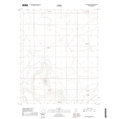
2018 Map of West Sunset Mountain
USGS Topo · Published 2018About this map
West Sunset Mtn anchors this high-desert landscape in Coconino County, where the terrain rises sharply from the surrounding flats to distinctive volcanic and sedimentary peaks. This modern 2018 survey reveals a landscape primarily defined by water management and topography, essential for ranching and wildlife in this arid region of Arizona. Strategic catchments like Rock House Tank, King Tank, and Porcupine Tank are scattered across the quadrangle, illustrating the vital infrastructure required to support life and livestock on the range.
Find a feature on this map
14 named features on this map. Tap any name to fly to it.
Don’t see what you’re looking for? This feature index may not catch every label — zoom into the map to look around manually.
Map Details
Editions of this 2018 West Sunset Mountain Map
This is the sole edition of this map. No revisions or reprints were ever made.
Other maps of this area

1883 · Tusayan
USGS Topo · 1:250,000

1886 · Tusayan
USGS Topo · 1:250,000

1886 · San Francisco Mtns
USGS Topo · 1:250,000

1886 · Holbrook
USGS Topo · 1:250,000

1887 · Verde
USGS Topo · 1:250,000

1891 · San Francisco Mtns
USGS Topo · 1:250,000

1892 · Verde
USGS Topo · 1:250,000

1893 · Holbrook
USGS Topo · 1:250,000

1894 · San Francisco Mtns
USGS Topo · 1:250,000

1899 · San Francisco Mtns
USGS Topo · 1:250,000