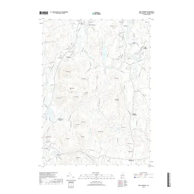
2018 Map of West Swanzey
USGS Topo · Published 2018About this map
The Ashuelot River and its South Branch define the settlement patterns of this Cheshire County landscape, where historical crossings like the West Swanzey Bridge, Coombs Bridge, and Carleton Bridge link the villages of West Swanzey, East Swanzey, and Swanzey. These river-spanning landmarks highlight the region's enduring reliance on the waterway for connectivity. The terrain rises sharply away from the river valleys into notable heights such as Mount Caesar, Bullard Mtn, and the Franconia Mtn Range, which overlook concentrated clusters of homes and seasonal sites like Camp Forest Lake.
Find a feature on this map
118 named features on this map. Tap any name to fly to it.
Don’t see what you’re looking for? This feature index may not catch every label — zoom into the map to look around manually.
Map Details
Editions of this 2018 West Swanzey Map
This is the sole edition of this map. No revisions or reprints were ever made.
Other maps of this area

1887 · Warwick
USGS Topo · 1:62,500

1887 · Winchendon
USGS Topo · 1:62,500

1889 · Warwick
USGS Topo · 1:62,500

1890 · Winchendon
USGS Topo · 1:62,500

1894 · Winchendon
USGS Topo · 1:62,500

1894 · Warwick
USGS Topo · 1:62,500

1898 · Monadnock
USGS Topo · 1:62,500

1898 · Keene
USGS Topo · 1:62,500

1932 · Warwick
USGS Topo · 1:48,000

1932 · Winchendon
USGS Topo · 1:48,000