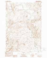
1990 Map of Westfall
USGS Topo · Published 1990About this map
The small settlement of Westfall sits at the northern edge of this high desert terrain, serving as a focal point in a landscape defined by seasonal water and pioneer history. A segment of the historic Oregon Trail passes through the southern portion of the quadrangle, tracing the path of 19th-century migration. Water management is critical in this arid region of Malheur County, evidenced by the Zimmerman Ditch and Harper Valley Canal, along with livestock and irrigation features like Hart Creek Reservoir and Allotment 4 Reservoir. The map documents a rugged interior marked by high points such as Danger Point and numerous natural water sources including Willow Spring and Hart Spring. Mineral extraction is present through several Open Pit Mines and a Gravel Pit, while local genealogy is rooted in the small Cem near the townsite and the remote Cemetery Spring.
Find a feature on this map
29 named features on this map. Tap any name to fly to it.
Don’t see what you’re looking for? This feature index may not catch every label — zoom into the map to look around manually.
Map Details
Editions of this 1990 Westfall Map
This is the sole edition of this map. No revisions or reprints were ever made.
Other maps of this area

1955 · Baker
USGS Topo · 1:250,000

1955 · Boise
USGS Topo · 1:250,000

1958 · Boise
USGS Topo · 1:250,000

1959 · Baker
USGS Topo · 1:250,000

1962 · Boise
USGS Topo · 1:250,000

1964 · Brogan
USGS Topo · 1:62,500

1966 · Clover Creek Ranch
USGS Topo · 1:62,500

1966 · Harper
USGS Topo · 1:62,500

1966 · Westfall Butte
USGS Topo · 1:62,500

1980 · Brogan
USGS Topo · 1:100,000