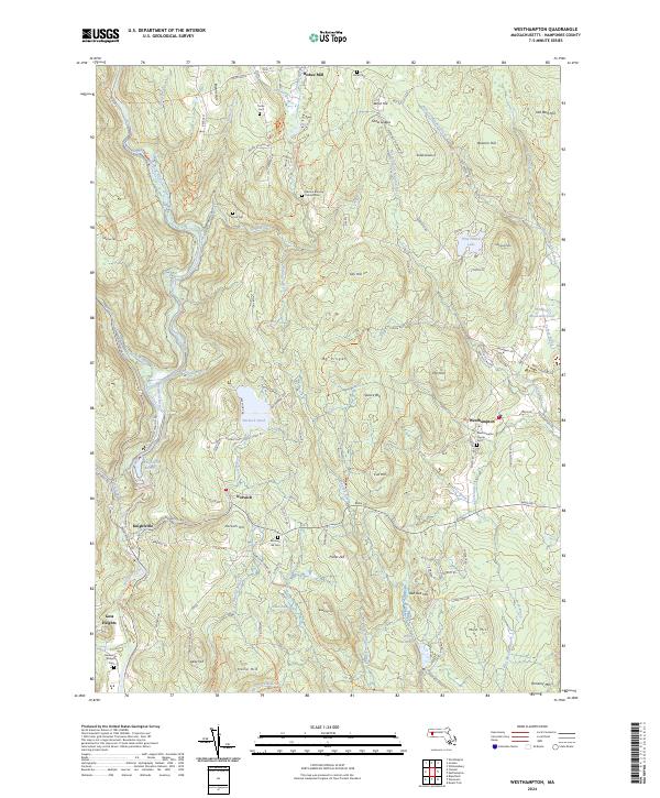
2024 Map of Westhampton
USGS Topo · Published 2024About this map
Westhampton and the village of Norwich center this exploration of the eastern Berkshire foothills, where the industrial legacy of Bisbee Mill sits near the headwaters of the North Branch Manhan River. The landscape is defined by its numerous family-named landmarks and historic burying grounds, such as the Damon Burying Ground Cem and Torrey Cem, which offer significant value for genealogists tracing early Hampshire County residents. To the west, the Westfield River corridor is dominated by the Knightville Reservoir and the Westfield Wild and Scenic River designation, illustrating the area's transition toward protected natural spaces. The map details a complex network of brooks, including Dead Branch and Roberts Meadow Brook, flowing between prominent elevations like Mt Pisgah and Pomeroy Mtn, revealing the topographic challenges that shaped local settlement patterns and early transport routes.
Find a feature on this map
120 named features on this map. Tap any name to fly to it.
Don’t see what you’re looking for? This feature index may not catch every label — zoom into the map to look around manually.
Map Details
Editions of this 2024 Westhampton Map
This is the sole edition of this map. No revisions or reprints were ever made.
Other maps of this area

1885 · Northampton
USGS Topo · 1:62,500

1886 · Springfield
USGS Topo · 1:62,500

1886 · Chesterfield
USGS Topo · 1:62,500

1886 · Northampton
USGS Topo · 1:62,500

1887 · Granville
USGS Topo · 1:62,500

1888 · Chesterfield
USGS Topo · 1:62,500

1889 · Springfield
USGS Topo · 1:62,500

1889 · Granville
USGS Topo · 1:62,500

1891 · Northampton
USGS Topo · 1:62,500

1893 · Northampton
USGS Topo · 1:62,500