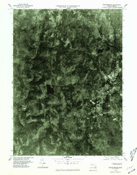
1975 Map of Westhampton
USGS Topo · Published 1981About this map
Westhampton and the surrounding hill country of Hampshire County are shown through detailed aerial imagery in this 1975 orthophotoquad. The landscape is defined by the winding course of the Westfield River and its tributary, the Little River, which carve through a mosaic of dense woodlots and small agricultural clearings. Distinctive upland water bodies like Pine Island Lake and Norwich Pond provide clear reference points for the local geography. Unlike a traditional line-drawn map, this photographic record reveals the exact density of the forest and the specific layout of rural homesteads near Westhampton and the small settlements of Norwich and Knightville. The contrast between the open valley floors and the steep, wooded ridges provides an unfiltered look at the land use patterns during the mid-1970s, before modern development further altered the regional character.
Find a feature on this map
7 named features on this map. Tap any name to fly to it.
Don’t see what you’re looking for? This feature index may not catch every label — zoom into the map to look around manually.
Map Details
Editions of this 1975 Westhampton Map
This is the sole edition of this map. No revisions or reprints were ever made.
Other maps of this area

1885 · Northampton
USGS Topo · 1:62,500

1886 · Springfield
USGS Topo · 1:62,500

1886 · Chesterfield
USGS Topo · 1:62,500

1886 · Northampton
USGS Topo · 1:62,500

1887 · Granville
USGS Topo · 1:62,500

1888 · Chesterfield
USGS Topo · 1:62,500

1889 · Springfield
USGS Topo · 1:62,500

1889 · Granville
USGS Topo · 1:62,500

1891 · Northampton
USGS Topo · 1:62,500

1893 · Northampton
USGS Topo · 1:62,500