1944 Map of Westminster
USGS Topo · Published 1944About this map
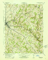
The Western Maryland railroad corridor serves as the industrial and logistical spine of this Carroll County landscape, connecting the county seat of Westminster to outlying hamlets. Beyond the concentrated development of the city, the terrain is defined by the branching tributaries of the North Branch Patapsco River, including the West Branch and East Branch. These waterways once supported local industry, evidenced by the presence of a Tannery and small rural stations like Cranberry Station.
Find a feature on this map
37 named features on this map. Tap any name to fly to it.
Don’t see what you’re looking for? This feature index may not catch every label — zoom into the map to look around manually.
Map Details
Editions of this 1944 Westminster Map
This is the sole edition of this map. No revisions or reprints were ever made.
Other maps of this area

1892 · Ellicott
USGS Topo · 1:62,500

1893 · Frederick
USGS Topo · 1:125,000

1894 · Ellicott
USGS Topo · 1:62,500

1894 · Frederick
USGS Topo · 1:125,000

1905 · Westminster
USGS Topo · 1:62,500

1906 · Ellicott
USGS Topo · 1:62,500

1908 · Patapsco
USGS Topo · 1:125,000

1909 · Mount Airy
USGS Topo · 1:62,500

1911 · Taneytown
USGS Topo · 1:62,500

1942 · Gettysburg
USGS Topo · 1:125,000