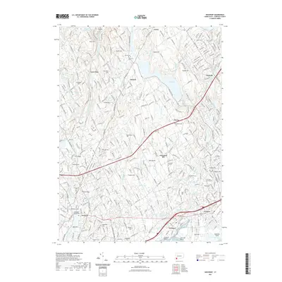
2021 Map of Westport
USGS Topo · Published 2021About this map
Fairfield and its surrounding coastal landscape are defined by a complex network of waterways and historical cemeteries that reflect centuries of community life. From the protected waters of Southport Harbor to the inland Saugatuck Reservoir and Hemlock Reservoir, the region's topography is a series of low hills like Greenfield Hill and Hickory Ridge. The coastal settlements of Westport and Southport are shown in their modern configuration, while the presence of ancient burial grounds such as Colonial Cem, Old West Cem, and Aspetuck Cem offers a point of reference for local genealogists.
Find a feature on this map
69 named features on this map. Tap any name to fly to it.
Don’t see what you’re looking for? This feature index may not catch every label — zoom into the map to look around manually.
Map Details
Editions of this 2021 Westport Map
This is the sole edition of this map. No revisions or reprints were ever made.
Other maps of this area

1889 · Derby
USGS Topo · 1:62,500

1891 · Bridgeport
USGS Topo · 1:62,500

1891 · Derby
USGS Topo · 1:62,500

1892 · Danbury
USGS Topo · 1:62,500

1892 · Norwalk
USGS Topo · 1:62,500

1893 · Bridgeport
USGS Topo · 1:62,500

1893 · Norwalk
USGS Topo · 1:62,500

1893 · Derby
USGS Topo · 1:62,500

1915 · Danbury
USGS Topo · 1:62,500

1920 · Bridgeport
USGS Topo · 1:62,500