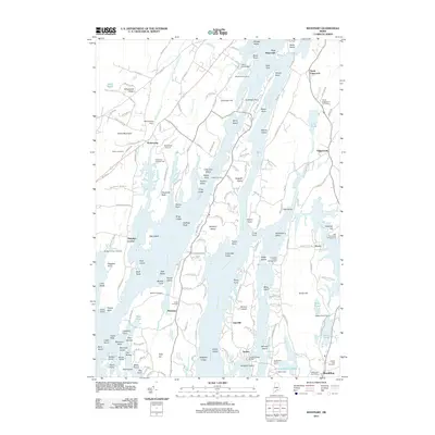
2011 Map of Westport
USGS Topo · Published 2011About this map
Fort Edgecomb stands at the northern narrows where the Sheepscot River and Back River converge, guarding the historical maritime approaches to the region. This 2011 survey illustrates the intricate island geography of Lincoln County, dominated by the long, slender profile of Westport Island and the smaller inhabited landmasses of Barters Island and Beal Island. The landscape is a complex network of tidal creeks and brackish ponds, such as Montsweag Brook and Heal Pond, which have long defined the local economy and settlement patterns.
Find a feature on this map
177 named features on this map. Tap any name to fly to it.
Don’t see what you’re looking for? This feature index may not catch every label — zoom into the map to look around manually.
Map Details
Editions of this 2011 Westport Map
This is the sole edition of this map. No revisions or reprints were ever made.
Other maps of this area

1892 · Gardiner
USGS Topo · 1:62,500

1893 · Wiscasset
USGS Topo · 1:62,500

1893 · Boothbay
USGS Topo · 1:62,500

1894 · Bath
USGS Topo · 1:62,500

1920 · Bath
USGS Topo · 1:62,500

1941 · Boothbay
USGS Topo · 1:62,500

1943 · Gardiner
USGS Topo · 1:62,500

1943 · Boothbay
USGS Topo · 1:62,500

1944 · Wiscasset
USGS Topo · 1:62,500

1944 · Boothbay
USGS Topo · 1:62,500