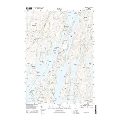
2014 Map of Westport
USGS Topo · Published 2014About this map
Fort Edgecomb stands sentinel over the Sheepscot River and The Eddy, marking a strategic coastal point where the tidal waters of Lincoln Co meet the complex shoreline of Westport Island. This maritime landscape is defined by its deep-water coves and narrow channels, including the treacherous passage at Lower Hell Gate and the sheltered reaches of Back River. The area serves as a focal point for aviation and naval history, anchored by the Wiscasset Airport and the historic fortifications at the river's mouth.
Find a feature on this map
229 named features on this map. Tap any name to fly to it.
Don’t see what you’re looking for? This feature index may not catch every label — zoom into the map to look around manually.
Map Details
Editions of this 2014 Westport Map
This is the sole edition of this map. No revisions or reprints were ever made.
Other maps of this area

1892 · Gardiner
USGS Topo · 1:62,500

1893 · Wiscasset
USGS Topo · 1:62,500

1893 · Boothbay
USGS Topo · 1:62,500

1894 · Bath
USGS Topo · 1:62,500

1920 · Bath
USGS Topo · 1:62,500

1941 · Boothbay
USGS Topo · 1:62,500

1943 · Gardiner
USGS Topo · 1:62,500

1943 · Boothbay
USGS Topo · 1:62,500

1944 · Wiscasset
USGS Topo · 1:62,500

1944 · Boothbay
USGS Topo · 1:62,500