
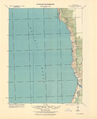
1921 Map of Westport
USGS Topo · Published 1921About this map
Westport and the surrounding Mendocino coastline appear here during a period of intense maritime and industrial activity. This tactical survey, compiled under Col. Chas. L. Potter, illustrates the rugged interface between the Pacific Ocean and the steep coastal range. The narrow shelf of habitable land is dotted with small lumbering and shipping outposts like Rockport, Hardy, and Newport.
Find a feature on this map
19 named features on this map. Tap any name to fly to it.
Don’t see what you’re looking for? This feature index may not catch every label — zoom into the map to look around manually.
Map Details
Editions of this 1921 Westport Map
2 editions found
Other maps of this area

1920 · Glenblair
USGS Topo · 1:62,500

1920 · Cummings
USGS Topo · 1:62,500

1920 · Fort Bragg
USGS Topo · 1:62,500

1921 · Branscomb
USGS Topo · 1:62,500

1943 · Glenblair
USGS Topo · 1:62,500

1943 · Fort Bragg
USGS Topo · 1:62,500

1950 · Piercy
USGS Topo · 1:62,500

1950 · Cape Vizcaino
USGS Topo · 1:62,500

1951 · Cape Vizcaino
USGS Topo · 1:62,500

1951 · Branscomb
USGS Topo · 1:62,500