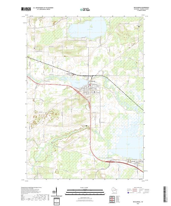
2022 Map of Weyauwega
USGS Topo · Published 2022About this map
Weyauwega serves as the focal point of this Waupaca County landscape, situated where the Waupaca River meets Weyauwega Lake. The town's grid is dense with residential streets like W Main St and S Mary St, while the surrounding countryside is defined by an intricate network of waterways and wetlands. To the south, the Wolf River flows into Partridge Lake near the village of Fremont, a region characterized by low-lying basins and meandering tributaries like Walla Walla Cr and Mosquito Cr. Several historic burying grounds, including Oakwood Cem and Evanswood Cem, are scattered across the township, providing essential points of reference for genealogists. The presence of Railroad Grade Rd indicates the path of former rail transit that once connected these river towns to the broader regional economy.
Find a feature on this map
87 named features on this map. Tap any name to fly to it.
Don’t see what you’re looking for? This feature index may not catch every label — zoom into the map to look around manually.
Map Details
Editions of this 2022 Weyauwega Map
This is the sole edition of this map. No revisions or reprints were ever made.
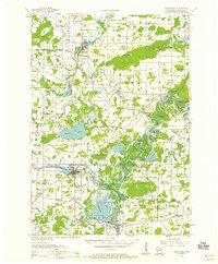
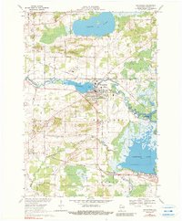
Historical Maps of Waupaca Through Time
3 maps found