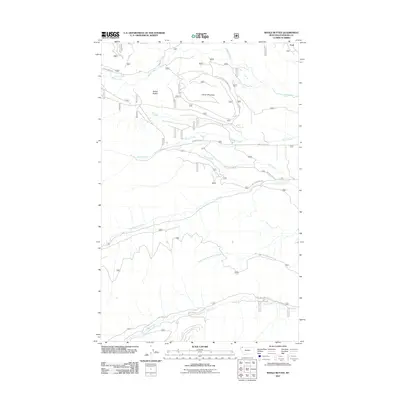
2011 Map of Whale Buttes
USGS Topo · Published 2011About this map
Whale Buttes and Center Mountain dominate this corner of Flathead County, representing a high-elevation landscape defined by its network of Forest Service access. In the early 21st century, the area near Ford shows a transition from drainage systems like Whale Creek and Moose Creek to the complex infrastructure of forest development roads. The map documents an extensive grid of service routes, including Whale Creek Rd and Red Meadow Rd, which provide access to the timber and recreational lands north of the main forks of Red Meadow Creek and the South Fork Red Meadow Creek. This road-heavy landscape reflects the modern management of these northern Montana forests, where names like Hawk Creek and Hay Creek mark the primary valleys and drainage basins utilized by foresters and local travelers.
Find a feature on this map
18 named features on this map. Tap any name to fly to it.
Don’t see what you’re looking for? This feature index may not catch every label — zoom into the map to look around manually.
Map Details
Editions of this 2011 Whale Buttes Map
This is the sole edition of this map. No revisions or reprints were ever made.
Other maps of this area

1906 · Kintla Lakes
USGS Topo · 1:125,000

1913 · Stryker
USGS Topo · 1:125,000

1916 · Stryker
USGS Topo · 1:125,000

1938 · Kintla Lakes
USGS Topo · 1:125,000

1957 · Kalispell
USGS Topo · 1:250,000

1960 · Kalispell
USGS Topo · 1:250,000

1961 · Kalispell
USGS Topo · 1:250,000

1966 · Red Meadow Lake
USGS Topo · 1:24,000

1966 · Kintla Lake
USGS Topo · 1:24,000

1966 · Mount Hefty
USGS Topo · 1:24,000