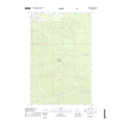
2020 Map of Whale Buttes
USGS Topo · Published 2020About this map
Flathead National Forest encompasses the high mountain terrain of the Whitefish Range in this northern Montana survey. The landscape is defined by the significant elevations of Whale Buttes and Center Mtn, which serve as prominent landmarks for navigation through the dense drainage basins. A complex network of water flows through these slopes, including Whale Creek to the north and the S Fork Red Meadow Cr through the central valley. The map documents an extensive system of forest development roads, such as Whale Creek Rd and Red Meadow Rd, which provide access to the backcountry. Of particular interest to hikers and historians is the route of the Pacific NW National Scenic Trail, which traverses the southern portion of the quadrangle near Hay Cr.
Find a feature on this map
36 named features on this map. Tap any name to fly to it.
Don’t see what you’re looking for? This feature index may not catch every label — zoom into the map to look around manually.
Map Details
Editions of this 2020 Whale Buttes Map
This is the sole edition of this map. No revisions or reprints were ever made.
Other maps of this area

1906 · Kintla Lakes
USGS Topo · 1:125,000

1913 · Stryker
USGS Topo · 1:125,000

1916 · Stryker
USGS Topo · 1:125,000

1938 · Kintla Lakes
USGS Topo · 1:125,000

1957 · Kalispell
USGS Topo · 1:250,000

1960 · Kalispell
USGS Topo · 1:250,000

1961 · Kalispell
USGS Topo · 1:250,000

1966 · Red Meadow Lake
USGS Topo · 1:24,000

1966 · Kintla Lake
USGS Topo · 1:24,000

1966 · Mount Hefty
USGS Topo · 1:24,000