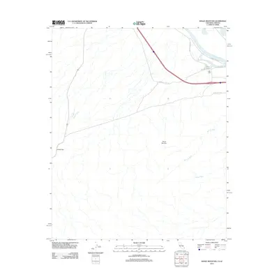
2012 Map of Whale Mountain
USGS Topo · Published 2012About this map
Whale Mountain anchors this arid landscape where the eastern Mojave Desert meets the life-giving waters of the Colorado River. Modern transit corridors and historic paths intersect here, with the National Trails Hwy and National Old Trails Rd cutting across the desert floor toward the river bank. The terrain is defined by dry drainage systems such as Bat Cave Wash and Mohave Wash, which reveal the natural hydrology that has shaped human passage for generations. To the west, Lobecks Pass provides a crucial natural gap in the topography, facilitating movement through the basin. This survey documents the intersection of essential infrastructure, including the Pipeline Access Rd and Railroad Access Rd, with the riparian environment near Park-Moabi Rd, illustrating how modern logistics are constrained by the ancient geography of the basin.
Find a feature on this map
11 named features on this map. Tap any name to fly to it.
Don’t see what you’re looking for? This feature index may not catch every label — zoom into the map to look around manually.
Map Details
Editions of this 2012 Whale Mountain Map
This is the sole edition of this map. No revisions or reprints were ever made.
Other maps of this area

1903 · Needles
USGS Topo · 1:125,000

1904 · Needles Special
USGS Topo · 1:125,000

1943 · Topock
USGS Topo · 1:62,500

1950 · Topock
USGS Topo · 1:62,500

1950 · Sawtooth Range
USGS Topo · 1:62,500

1950 · Needles
USGS Topo · 1:62,500

1951 · Topock
USGS Topo · 1:62,500

1951 · Sawtooth Range
USGS Topo · 1:62,500

1952 · Needles
USGS Topo · 1:62,500

1954 · Needles
USGS Topo · 1:250,000