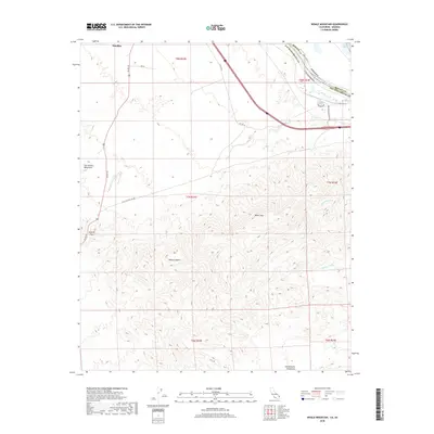
2018 Map of Whale Mountain
USGS Topo · Published 2018About this map
The Colorado River defines the border between California and Arizona as it flows south toward the Topock Marsh, marking a point where water management and desert infrastructure converge. The landscape is dominated by the massive relief of the Sacramento Mountains and Whale Mtn, cut by prominent drainage features like Bat Cave Wash and Mohave Wash. This modern survey illustrates the persistent importance of transportation corridors in this arid region, showing the routes of US Rte 95 and HST Rte 66 as they navigate the basin.
Find a feature on this map
26 named features on this map. Tap any name to fly to it.
Don’t see what you’re looking for? This feature index may not catch every label — zoom into the map to look around manually.
Map Details
Editions of this 2018 Whale Mountain Map
This is the sole edition of this map. No revisions or reprints were ever made.
Other maps of this area

1903 · Needles
USGS Topo · 1:125,000

1904 · Needles Special
USGS Topo · 1:125,000

1943 · Topock
USGS Topo · 1:62,500

1950 · Topock
USGS Topo · 1:62,500

1950 · Sawtooth Range
USGS Topo · 1:62,500

1950 · Needles
USGS Topo · 1:62,500

1951 · Topock
USGS Topo · 1:62,500

1951 · Sawtooth Range
USGS Topo · 1:62,500

1952 · Needles
USGS Topo · 1:62,500

1954 · Needles
USGS Topo · 1:250,000