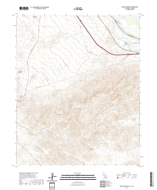
2021 Map of Whale Mountain
USGS Topo · Published 2021About this map
The Colorado River forms a critical border between California and Arizona at the northern edge of this desert landscape, where the waters of Lost Lake sit near the transition to the Sacramento Mountains. To the south, the topography is dominated by the Whale Mtn massif and the northern reaches of the Chemehuevi Mountains, separated by drainage systems like Bat Cave Wash and Mohave Wash. This area serves as a significant transit corridor through the Mojave Desert, marked by the path of Hst Rte 66 and Us Rte 95. The industrial footprint is visible through the S Cal Gas Pipe Line Rd, which traverses the arid terrain west of Whale Mtn. Cultural and topographic landmarks like Lobecks Pass provide specific points of reference for those tracing historical travel routes across the San Bernardino County line.
Find a feature on this map
25 named features on this map. Tap any name to fly to it.
Don’t see what you’re looking for? This feature index may not catch every label — zoom into the map to look around manually.
Map Details
Editions of this 2021 Whale Mountain Map
This is the sole edition of this map. No revisions or reprints were ever made.
Other maps of this area

1903 · Needles
USGS Topo · 1:125,000

1904 · Needles Special
USGS Topo · 1:125,000

1943 · Topock
USGS Topo · 1:62,500

1950 · Topock
USGS Topo · 1:62,500

1950 · Sawtooth Range
USGS Topo · 1:62,500

1950 · Needles
USGS Topo · 1:62,500

1951 · Topock
USGS Topo · 1:62,500

1951 · Sawtooth Range
USGS Topo · 1:62,500

1952 · Needles
USGS Topo · 1:62,500

1954 · Needles
USGS Topo · 1:250,000