2022 Map of Wharton
USGS Topo · Published 2022About this map
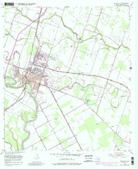
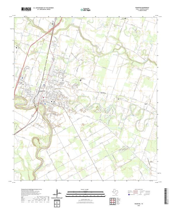
The Colorado River defines the southwestern edge of this landscape, winding past the seat of local government at the Wharton County Courthouse. This 2022 survey captures the city of Wharton as a regional center of education and health, anchored by the Wharton County Junior College Main Campus and several medical facilities. The area's complex social history is written in its many dedicated burial grounds, including the Wharton County Cem, the Wharton Hispanic Cem, and the Shearith Israel Cem. Beyond the city limits, the terrain transitions into a patchwork of rural roads and water features like Peach Creek and Baughman Slough. Smaller communities such as Dinsmore and Burr sit among the agricultural tracts, while landmarks like Lackey Aviation indicate the area's modern infrastructure and transport links.
Find a feature on this map
169 named features on this map. Tap any name to fly to it.
Don’t see what you’re looking for? This feature index may not catch every label — zoom into the map to look around manually.
Map Details
Editions of this 2022 Wharton Map
This is the sole edition of this map. No revisions or reprints were ever made.