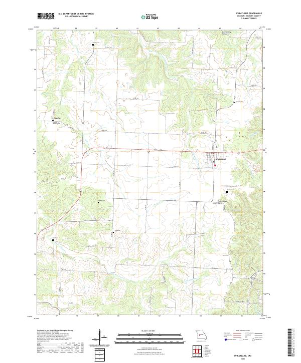
2021 Map of Wheatland
USGS Topo · Published 2021About this map
Wheatland serves as the primary hub of this Hickory County landscape, situated at the intersection of State Hwy T and Co Rd 180. The terrain is defined by the winding paths of the Little Pomme de Terre River and Little Weaubleau Cr, which create a network of valleys including Montgomery Hollow and Cedar Hollow. For genealogists, the map is remarkably dense with family-named burial sites, such as the Fairview Butcher Cem near the settlement of Butcher, and the centrally located Gerber Cem. The rural infrastructure is characterized by a high concentration of county roads like Co Rd 160 and Co Rd 240, connecting scattered homesteads across the drainage basins of Hogles Cr and Green Br.
Find a feature on this map
58 named features on this map. Tap any name to fly to it.
Don’t see what you’re looking for? This feature index may not catch every label — zoom into the map to look around manually.
Map Details
Editions of this 2021 Wheatland Map
This is the sole edition of this map. No revisions or reprints were ever made.
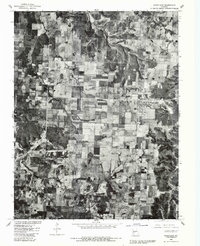
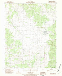
Historical Maps of Butcher Through Time
3 maps found