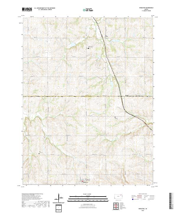
2022 Map of Wheaton
USGS Topo · Published 2022About this map
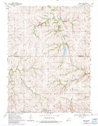
The borderlands of Marshall and Pottawatomie counties in northeastern Kansas are defined by a network of creeks and prairie roads centered on the town of Wheaton. At the southern edge of the sheet, Wheaton is anchored by Saint Luke Lutheran church, serving as a hub for the surrounding agricultural community. The landscape is carved by the Clear Fork and Irish Cr, which wind through the township, and the small settlements of Lillis and Nolan provide further evidence of the area's rural development.
Find a feature on this map
49 named features on this map. Tap any name to fly to it.
Don’t see what you’re looking for? This feature index may not catch every label — zoom into the map to look around manually.
Map Details
Editions of this 2022 Wheaton Map
This is the sole edition of this map. No revisions or reprints were ever made.