Old Maps of Marshall County, Kansas
Explore 186 old maps of Marshall County, spanning from 1889 to today. These high-resolution historic maps reveal how streets, neighborhoods, landmarks, and natural features evolved over time — perfect for genealogy, metal detecting, research, and local history exploration.
What you can do with these maps:
- See how Marshall County changed over time: Compare historical maps to modern-day views to trace roads, homesites, rail lines & more.
- View detailed metadata: Each map includes creators, publishers, year, scale, and archive source.
- Overlay maps with satellite & LiDAR: Visualize the past alongside modern tools to explore terrain & human change.
- Trusted historical sources: Maps sourced from the USGS, Library of Congress, and other archives.
- Access maps your way: View online, download high-res files, or order prints for personal or research use.
Start exploring old maps of Marshall County to uncover forgotten places, hidden landmarks, and the deep history beneath your feet.
Marshall County, KS maps
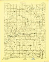
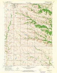
(186)- 1889 Map of Seneca
 1889 Seneca1889 Print · USGSNortheast Kansas was a bustling intersection of frontier rail lines in the late nineteenth century. Genealogists and local historians can trace the early development of towns like Seneca and Centralia along the Missouri Pacific Railroad and other historic transit corridors.
 - 1889 Map of Marysville
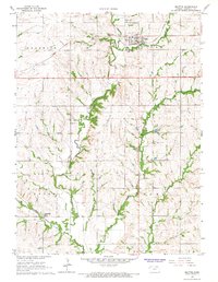
 1889 Marysville1889 Print · USGSMarshall County in the late nineteenth century was a bustling nexus of river trade and steam rail expansion. Genealogists and historians can trace early town sites like Marysville, Blue Rapids, and Irving along the Little Blue River and major rail lines.
 - 1894 Map of Seneca
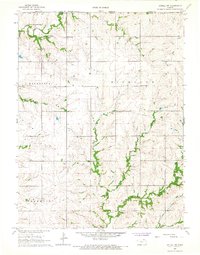
 1894 Seneca1894 Print · USGSNortheastern Kansas is captured here in the late nineteenth century as a thriving rail and river corridor. You can trace early community sites like Guittard Station, Taylor Rapids, and America City along the Missouri Pacific Railroad.4 unique versions available
 - 1894 Map of Marysville
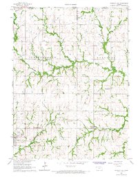
 1894 Marysville1894 Print · USGSMarshall County's river valleys and railroad corridors are intricately detailed in the 1880s, before modern highway expansion altered the rural landscape. Genealogists can locate family lands near Ballard Falls, Bremen, or the rail junctions at Marysville.4 unique versions available
 - 1955 Map of Manhattan, 1964 Print
 1955 Manhattan1964 Print · USGSNorth Central Kansas is captured here in the mid-fifties, just as major flood control projects began reshaping the river valleys. Genealogists can locate family sites near St. Joseph Church, Sunset Cemetery, or along the busy tracks of the Rock Island RR.4 unique versions available
 - 1955 Map of Lincoln, 1967 Print
 1955 Lincoln1967 Print · USGSSoutheast Nebraska in the mid-fifties presents a landscape of thriving railroad towns and the expanding footprint of the capital city. Researchers can trace the legacy of the pioneer era at the Homestead National Monument of America or locate mid-century military infrastructure like Lincoln Air Force Base.5 unique versions available
 - 1956 Map of Manhattan
 1956 Manhattan1956 Print · USGSNorth-central Kansas in the mid-fifties reveals a landscape defined by the convergence of the Republican River and Smoky Hill River. Historians can trace the rail corridors of the Union Pacific RR and Missouri Pacific RR through towns like Manhattan and Clay Center.
 - 1957 Map of Manhattan
 1957 Manhattan1957 Print · USGSNortheast Kansas in the mid-1950s reveals a landscape of expanding military installations and new water projects. Genealogists and historians can trace the rail-to-river economy through the Union Pacific RR and old settlements like Clay Center or Marysville.
 - 1957 Map of Lincoln
 1957 Lincoln1957 Print · USGSSoutheastern Nebraska at mid-century shows a landscape of thriving rail towns and expanding infrastructure centered on Lincoln. Researchers can trace the path of the Chicago Burlington and Quincy railroad through communities like Weeping Water, Fairmont, and Seward.
 - 1958 Map of Lincoln
 1958 Lincoln1958 Print · USGSSoutheast Nebraska at the end of the 1950s shows a region defined by agricultural trade and the expansion of the state capital. Genealogists can trace family footprints across the Blue Valley and locate landmarks like the Lincoln AFB or the U.S. Veterans Hospital.
 - 1965 Map of Pawnee City, 1966 Print
 1965 Pawnee City1966 Print · USGSSoutheast Nebraska in the mid-sixties reveals a landscape of rural schoolhouses and busy rail junctions centered on Pawnee City. Researchers can trace old property lines and family landmarks like Barker School, Evergreen Cemetery, and the Rock Island Railroad.
 - 1965 Map of Liberty SE, 1966 Print
 1965 Liberty SE1966 Print · USGSCrossing the Nebraska-Kansas border in the mid-1960s, this area captures the rural character of Pawnee and Marshall counties. Genealogists and historians can trace the Old Railroad Grade and locate local landmarks like Summerfield Cem and Salem Sch.
 - 1965 Map of Liberty, 1968 Print
 1965 Liberty1968 Print · USGSThe Nebraska-Kansas border comes into focus in the mid-1960s, showing the agricultural landscape and rail lines of Gage and Pawnee Counties. Researchers can locate family landmarks like Mission Creek Cem and Liberty Cem or trace the Chicago Burlington and Quincy Railroad.2 unique versions available
 - 1966 Map of Oketo, 1967 Print
 1966 Oketo1967 Print · USGSMarshall County at the edge of the Nebraska border shows a landscape defined by river transport and historic territorial lines in the mid-1960s. Genealogists and historians can trace the Old Indian Treaty Boundary, local schools like Midway Sch, and the riverside tracks of the Union Pacific.
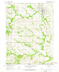
 - 1966 Map of Marysville, 1967 Print
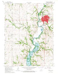 1966 Marysville1967 Print · USGSMarysville and the surrounding Marshall County countryside are documented here in the mid-sixties, just as the Tuttle Creek Reservoir shaped the river valley. Researchers can trace the layout of Marysville neighborhoods and find rural landmarks like Shroyer Cem and Aleove Spring.2 unique versions available
 - 1966 Map of Seneca NW, 1967 Print
 1966 Seneca NW1967 Print · USGSNortheast Kansas in the mid-1960s was a landscape of deeply etched creek valleys and tidy township squares. Genealogists and local historians can trace family land in St Bridget or Marion and locate the historic Madden Cem tucked away near the county line.
 - 1966 Map of Hanover SE, 1967 Print
 1966 Hanover SE1967 Print · USGSWashington and Marshall County lands are shown here in the mid-1960s as the Little Blue River meets the Tuttle Creek Reservoir. Family historians can locate several rural landmarks, including Pecenka Cem, Evergreen Cem, and the Trinity Ch.2 unique versions available
 - 1966 Map of Herkimer, 1967 Print
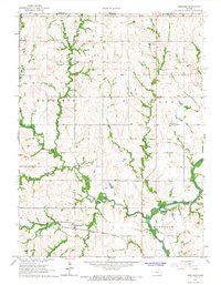 1966 Herkimer1967 Print · USGSThe northern Kansas borderlands near the Nebraska line are captured here in the mid-1960s, showing a landscape defined by pioneer-era boundaries and small-town roots. Genealogists can trace family locations through numerous rural landmarks like Zion Cem, Lone Elm, and the Bethlehem Sch (Cem).2 unique versions available
 - 1966 Map of Baileyville, 1967 Print
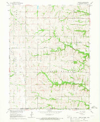
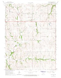 1966 Baileyville1967 Print · USGSNortheast Kansas in the mid-1960s shows a landscape of steady agricultural life along the Union Pacific corridor. Researchers can trace land use through detailed fence lines and locate local landmarks like Sacred Heart Cem and the small hub of Baileyville.
 - 1966 Map of Axtell, 1967 Print
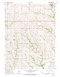 1966 Axtell1967 Print · USGSIn the mid-sixties, the agricultural landscape of Marshall County centered on Axtell and its vital Union Pacific rail connection. Genealogists and local historians can trace family roots through rural landmarks like Mission Covenant Ch and the Salem Ch.2 unique versions available
 - 1966 Map of Home, 1967 Print
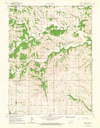
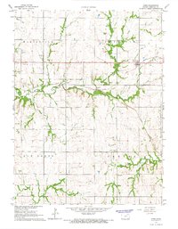 1966 Home1967 Print · USGSMarshall County in the mid-1960s shows a landscape defined by the Union Pacific rails and small prairie communities. Genealogists and historians can trace family locations near Home City Cem, the settlement of Reedsville, and local landmarks like the Water Tank or St Gregorys Cem.
 - 1966 Map of Summerfield, 1967 Print
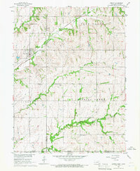
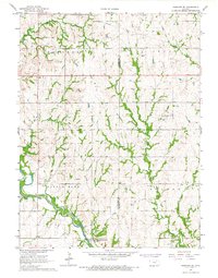
 1966 Summerfield1967 Print · USGSThe Kansas-Nebraska borderlands in Marshall County come to life in the mid-1960s, showing a landscape defined by rail lines and rural townships. Genealogists and historians can trace family plots at St Bridget Cem and Rose Hill Cem, or follow the Union Pacific tracks through Axtell.2 unique versions available
 - 1966 Map of Beattie, 1967 Print
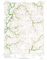
 1966 Beattie1967 Print · USGSMarshall County's agricultural and rail-oriented landscape is captured in the mid-1960s as the Union Pacific corridor connects rural communities. Local historians can trace family ties at the Beattie Union Cem and Life Cem, or locate the site of St Malachys Ch and Winifred.
 - 1966 Map of Axtell NW, 1967 Print
 1966 Axtell NW1967 Print · USGSMarshall County rural life in the 1960s is captured here at the Nebraska-Kansas border. Genealogists and historians can trace family roots at Mission Creek Cemetery or locate the Mission Creek Community Center and Richland Center Church.
 - 1966 Map of Hanover East, 1967 Print
 1966 Hanover East1967 Print · USGSWashington County at the Nebraska border comes into focus in the mid-sixties, revealing a landscape defined by rail lines and historic trails. Trace the Old Indian Treaty Boundary or locate family roots at St Johns Cem and Trinity Ch.2 unique versions available
Showing maps 1-25 of 186
Top cities of Marshall County
- Marysville historical maps
- Blue Rapids historical maps
- Frankfort historical maps
- Waterville historical maps
- Axtell historical maps
- Beattie historical maps
See more
Frequently asked questions
- What are the different types of historical maps available for Marshall County?
- What is the oldest map of Marshall County?
- Where can I purchase historical maps of Marshall County for my home or office?
- Where can I download high-res historical maps of Marshall County?
- Are there historical topographic maps available for Marshall County?
- Is there historical aerial imagery available for Marshall County?
- Where are historical maps of Marshall County sourced from?