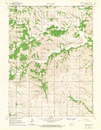
1966 Map of Seneca NW
USGS Topo · Published 1967About this map
The rolling hills of northeast Kansas are defined here by a network of drainage basins, notably where Black Vermillion and the North Fork Wildcat Creek carve through the landscape. This 1966 survey documents a rural environment organized by civil townships, including St Bridget, Clear Creek, Murray, and Marion. The map captures a moment when the land was almost exclusively dedicated to agriculture, with occasional infrastructure such as a prominent Pipeline cutting across the southern sections.
Find a feature on this map
16 named features on this map. Tap any name to fly to it.
Don’t see what you’re looking for? This feature index may not catch every label — zoom into the map to look around manually.
Map Details
Editions of this 1966 Seneca NW Map
This is the sole edition of this map. No revisions or reprints were ever made.
Other maps of this area

1889 · Seneca
USGS Topo · 1:125,000

1894 · Seneca
USGS Topo · 1:125,000

1955 · Manhattan
USGS Topo · 1:250,000

1955 · Lincoln
USGS Topo · 1:250,000

1956 · Manhattan
USGS Topo · 1:250,000

1957 · Manhattan
USGS Topo · 1:250,000

1957 · Lincoln
USGS Topo · 1:250,000

1958 · Lincoln
USGS Topo · 1:250,000

1965 · Pawnee City
USGS Topo · 1:24,000
1965 · Du Bois
USGS Topo · 1:24,000