
1894 Map of Seneca
USGS Topo · Published 1894About this map
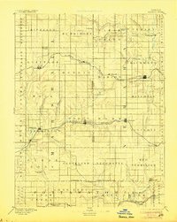
Seneca serves as a prominent rail hub in this late nineteenth-century survey of northeastern Kansas, where the St. Joseph and Grand Island Railroad intersects with the local topography. The landscape is defined by the drainage basins of the Nemaha River and the Black Vermillion River, which dictate the placement of early settlements and agricultural boundaries. Regional transit is heavily influenced by three distinct rail lines, including the Missouri Pacific Railroad passing through Centralia and the Kansas Central Br. serving the southern reaches near Havensville and Wheaton. Small rural centers such as St.Bridget, Guittard Station, and Taylor Rapids illustrate the dense network of townships like Murray and Richland before the full consolidation of modern towns. Genealogists can trace early post offices and community sites such as America City and Wyoming, which were vital nodes in the 1880s prairie economy.
Find a feature on this map
77 named features on this map. Tap any name to fly to it.
Don’t see what you’re looking for? This feature index may not catch every label — zoom into the map to look around manually.
Map Details
Editions of this 1894 Seneca Map
4 editions found
Other maps of this area

1886 · Junction City
USGS Topo · 1:125,000

1888 · Hiawatha
USGS Topo · 1:125,000

1889 · Seneca
USGS Topo · 1:125,000

1889 · Wamego
USGS Topo · 1:125,000

1889 · Marysville
USGS Topo · 1:125,000

1889 · Junction City
USGS Topo · 1:125,000

1889 · Topeka
USGS Topo · 1:125,000

1894 · Junction City
USGS Topo · 1:125,000

1894 · Topeka
USGS Topo · 1:125,000

1894 · Hiawatha
USGS Topo · 1:125,000