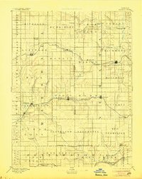
1894 Map of Seneca
USGS Topo · Published 1906About this map
Seneca serves as a central hub on this northern Kansas landscape surveyed just decades after the region's initial settlement. The map reveals a transition from frontier outposts to established rail towns, connected by the St Joseph and Grand Island Railroad in the north and the Missouri Pacific Railroad further south. Notable for genealogists are the smaller settlements and stations often bypassed by modern development, including St.Bridget, Guittard Station, and St.Benedict.
Find a feature on this map
74 named features on this map. Tap any name to fly to it.
Don’t see what you’re looking for? This feature index may not catch every label — zoom into the map to look around manually.
Map Details
Editions of this 1894 Seneca Map
4 editions found
Other maps of this area

1886 · Junction City
USGS Topo · 1:125,000

1888 · Hiawatha
USGS Topo · 1:125,000

1889 · Seneca
USGS Topo · 1:125,000

1889 · Wamego
USGS Topo · 1:125,000

1889 · Marysville
USGS Topo · 1:125,000

1889 · Junction City
USGS Topo · 1:125,000

1889 · Topeka
USGS Topo · 1:125,000

1894 · Junction City
USGS Topo · 1:125,000

1894 · Seneca
USGS Topo · 1:125,000

1894 · Topeka
USGS Topo · 1:125,000