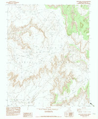
1982 Map of White Area Canyon
USGS Topo · Published 1983About this map
The high desert landscape of Apache County is documented here within the Navajo Indian Reservation, showing a complex system of drainage and relief as it was recorded in the late 1970s. The eponymous White Area Canyon dominates the central portion of the sheet, carving through the terrain alongside significant landforms like Alcove Mesa. Water sources, critical to life in this arid region, are marked by names such as White Area Spring and the winding course of Hashiditibi Creek. This provisional survey preserves the technical footprints of resource exploration and ranching, noting a Drill Hole and a Windmill situated among the network of unimproved roads and trails. The map serves as a detailed record of the physical geography and sparse infrastructure within the reservation boundaries prior to the 1982 map editing process.
Find a feature on this map
8 named features on this map. Tap any name to fly to it.
Don’t see what you’re looking for? This feature index may not catch every label — zoom into the map to look around manually.
Map Details
Editions of this 1982 White Area Canyon Map
This is the sole edition of this map. No revisions or reprints were ever made.
Other maps of this area

1892 · Canyon De Chelly
USGS Topo · 1:250,000

1953 · Los Gigantes NE
USGS Topo · 1:24,000

1953 · Los Gigantes NW
USGS Topo · 1:24,000

1953 · Los Gigantes SE
USGS Topo · 1:24,000

1953 · Dinne Mesa SW
USGS Topo · 1:24,000

1953 · Los Gigantes SW
USGS Topo · 1:24,000

1953 · Dinne Mesa SE
USGS Topo · 1:24,000

1953 · Toh-Atin Mesa
USGS Topo · 1:62,500

1953 · Los Gigantes Buttes
USGS Topo · 1:62,500

1954 · Shiprock
USGS Topo · 1:250,000