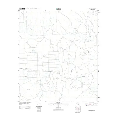
2012 Map of White Hills
USGS Topo · Published 2012About this map
The high desert landscape of Brewster County is defined here by extensive mesa formations and deeply cut canyons. Jack Eden Mesa and Eastwood Mesa dominate the southern half of the quadrangle, while the namesake White Hills rise to the north. Water is a critical and sparse resource in this environment, marked by isolated sites like Cottonwood Spring, Little Corazones Spring, and Double Tanks. This 2012 survey illustrates the modern ranching and land use patterns of the Big Bend region, centered on the Saucier Ranch and a network of private and service roads. Traces of historical movement and modern utility are visible in the grid-like system south of Jack Eden Mesa, where Terlingua Ranch Rd and Snake Rd provide access through the arid terrain. The map also documents drainage systems through Burnt Willow Canyon and the closely paired Cartwright Canyon and Pipeline Canyon.
Find a feature on this map
17 named features on this map. Tap any name to fly to it.
Don’t see what you’re looking for? This feature index may not catch every label — zoom into the map to look around manually.
Map Details
Editions of this 2012 White Hills Map
This is the sole edition of this map. No revisions or reprints were ever made.
Other maps of this area

1903 · Chisos Mountains
USGS Topo · 1:125,000

1903 · Terlingua
USGS Topo · 1:125,000

1904 · Terlingua
USGS Topo · 1:125,000

1905 · Chisos Mountains
USGS Topo · 1:125,000

1917 · Agua Fria
USGS Topo · 1:62,500

1918 · Bone Spring
USGS Topo · 1:125,000

1918 · Nine Point Mesa
USGS Topo · 1:62,500

1937 · Nine Point Mesa
USGS Topo · 1:62,500

1937 · Agua Fria
USGS Topo · 1:62,500

1959 · Emory Peak
USGS Topo · 1:250,000