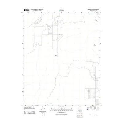
2011 Map of White Hills East
USGS Topo · Published 2011About this map
White Hills serves as the focal point of this arid Mojave landscape, showing a developing network of residential roads such as Cyclopic Blvd and Rollando Dr appearing alongside traditional ranching and mining-era outposts. The map reveals a transition from the structured street grids of the high desert community to the surrounding open range, where water sources remain critical landmarks. Vital points such as Red Willow Spring, Alta Spring, and Skipper Tank are plotted across the terrain, indicating the historical importance of water management in this part of Mohave County. In the northeast, the elevation rises toward the Table Mountain Plateau, while established sites like Jeffs Camp and Butcher Camp reflect the area's sparse but persistent settlement. The infrastructure of Co Hwy 145 links these remote desert reaches to the broader region during this period of early 21st-century growth.
Find a feature on this map
46 named features on this map. Tap any name to fly to it.
Don’t see what you’re looking for? This feature index may not catch every label — zoom into the map to look around manually.
Map Details
Editions of this 2011 White Hills East Map
This is the sole edition of this map. No revisions or reprints were ever made.
Other maps of this area

1886 · Camp Mohave
USGS Topo · 1:250,000

1892 · Camp Mohave
USGS Topo · 1:250,000

1942 · Camp Mohave
USGS Topo · 1:250,000

1947 · Kingman
USGS Topo · 1:250,000

1948 · Kingman
USGS Topo · 1:250,000

1954 · Kingman
USGS Topo · 1:250,000

1955 · Kingman
USGS Topo · 1:250,000

1958 · Kingman
USGS Topo · 1:250,000

1960 · Kingman
USGS Topo · 1:250,000
1960 · Senator Mountain
USGS Topo · 1:62,500