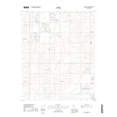
2018 Map of White Hills East
USGS Topo · Published 2018About this map
White Hills serves as the focal point of this arid landscape, showing a network of residential streets carved into the desert floor. The area is characterized by a mix of planned development and the natural extremes of the Mojave Desert. To the east, the Table Mountain Plateau rises above the valley, providing a sharp topographic contrast to the surrounding alluvial fans. This 2018 survey reveals a modern residential footprint, with long thoroughfares like Cyclopic Blvd and Silver Eagle Dr intersecting the landscape. Despite the development, the map traces the essential presence of water in this environment through established sources like Alta Spring, Mountain Spring, and Rock Spring, which likely dictated the historical viability of this corner of Mohave County.
Find a feature on this map
75 named features on this map. Tap any name to fly to it.
Don’t see what you’re looking for? This feature index may not catch every label — zoom into the map to look around manually.
Map Details
Editions of this 2018 White Hills East Map
This is the sole edition of this map. No revisions or reprints were ever made.
Other maps of this area

1886 · Camp Mohave
USGS Topo · 1:250,000

1892 · Camp Mohave
USGS Topo · 1:250,000

1942 · Camp Mohave
USGS Topo · 1:250,000

1947 · Kingman
USGS Topo · 1:250,000

1948 · Kingman
USGS Topo · 1:250,000

1954 · Kingman
USGS Topo · 1:250,000

1955 · Kingman
USGS Topo · 1:250,000

1958 · Kingman
USGS Topo · 1:250,000

1960 · Kingman
USGS Topo · 1:250,000
1960 · Senator Mountain
USGS Topo · 1:62,500