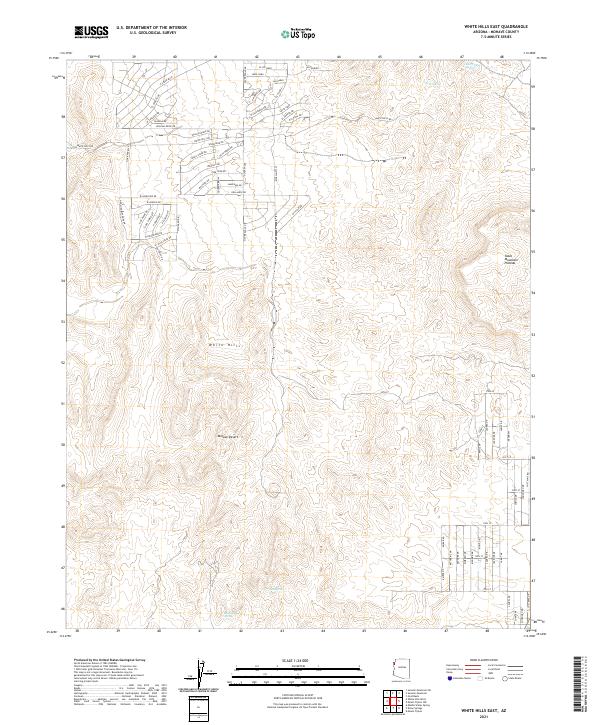
2021 Map of White Hills East
USGS Topo · Published 2021About this map
White Hills rise from the Mojave Desert floor in this 2021 record of northwestern Arizona. The map illustrates a distinctive pattern of planned residential development characterized by an extensive network of named roads such as N Spear Blvd and White Hills Rd cutting across the arid landscape. These modern corridors, with names like Vista Verde Dr and San Pablo, contrast sharply with the natural features of the high desert. To the east, the elevation climbs toward the Table Mountain Plateau. Throughout this dry terrain, small water sources remain vital landmarks for navigation and local history, including Red Willow Spring, Rock Spring, and Alta Spring. The document serves as a clear indicator of how modern subdivision planning has been mapped onto the traditional open ranges of Mohave County.
Find a feature on this map
74 named features on this map. Tap any name to fly to it.
Don’t see what you’re looking for? This feature index may not catch every label — zoom into the map to look around manually.
Map Details
Editions of this 2021 White Hills East Map
This is the sole edition of this map. No revisions or reprints were ever made.
Other maps of this area

1886 · Camp Mohave
USGS Topo · 1:250,000

1892 · Camp Mohave
USGS Topo · 1:250,000

1942 · Camp Mohave
USGS Topo · 1:250,000

1947 · Kingman
USGS Topo · 1:250,000

1948 · Kingman
USGS Topo · 1:250,000

1954 · Kingman
USGS Topo · 1:250,000

1955 · Kingman
USGS Topo · 1:250,000

1958 · Kingman
USGS Topo · 1:250,000

1960 · Kingman
USGS Topo · 1:250,000
1960 · Senator Mountain
USGS Topo · 1:62,500