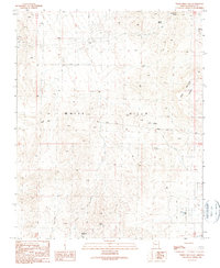
1989 Map of White Hills East
USGS Topo · Published 1990About this map
Mining and ranching infrastructure define this arid landscape within the White Hills of Mohave County during the late 1980s. The topography is dominated by the Table Mountain Plateau to the northeast, with the terrain marked by evidence of resource extraction including a Mine Shaft, an Adit, and several Prospects. Water, the most critical resource in this high desert environment, is carefully managed through a series of named points such as Red Willow Spring, Alto Spring, and Mountain Spring, alongside various catchment and pumping sites like Sacaton Dam and the Butcher Windmill.
Find a feature on this map
23 named features on this map. Tap any name to fly to it.
Don’t see what you’re looking for? This feature index may not catch every label — zoom into the map to look around manually.
Map Details
Editions of this 1989 White Hills East Map
This is the sole edition of this map. No revisions or reprints were ever made.
Other maps of this area

1886 · Camp Mohave
USGS Topo · 1:250,000

1892 · Camp Mohave
USGS Topo · 1:250,000

1942 · Camp Mohave
USGS Topo · 1:250,000

1947 · Kingman
USGS Topo · 1:250,000

1948 · Kingman
USGS Topo · 1:250,000

1954 · Kingman
USGS Topo · 1:250,000

1955 · Kingman
USGS Topo · 1:250,000

1958 · Kingman
USGS Topo · 1:250,000

1960 · Kingman
USGS Topo · 1:250,000
1960 · Senator Mountain
USGS Topo · 1:62,500