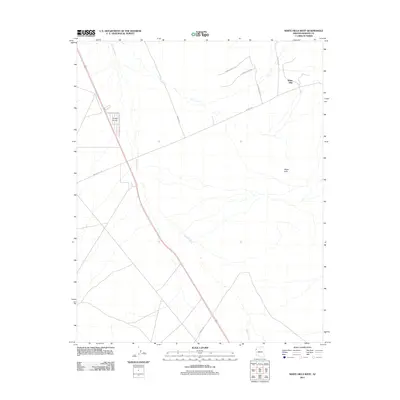
2011 Map of White Hills West
USGS Topo · Published 2011About this map
Detrital Wash dominates the hydrology of this arid Mohave County landscape, its winding course cutting through the desert floor just east of Triangle Airpark. The area exhibits a transition from open desert to the rising terrain of the White Hills in the northeast. This 2011 survey illustrates the modern road network servicing the region, where Co Hwy 145 and White Hills Rd provide primary access. A residential grid is visible in the northeastern corner, with named streets like W Santa Bella Dr and Hitching Post Dr indicating the expansion of rural development into the traditional ranching or mining lands of northern Arizona. The layout suggests a community designed around both vehicular and perhaps light aviation access, centered near the prominent airpark facility.
Find a feature on this map
11 named features on this map. Tap any name to fly to it.
Don’t see what you’re looking for? This feature index may not catch every label — zoom into the map to look around manually.
Map Details
Editions of this 2011 White Hills West Map
This is the sole edition of this map. No revisions or reprints were ever made.
Other maps of this area

1886 · Camp Mohave
USGS Topo · 1:250,000

1892 · Camp Mohave
USGS Topo · 1:250,000

1926 · Nelson
USGS Topo · 1:96,000

1942 · Camp Mohave
USGS Topo · 1:250,000

1947 · Kingman
USGS Topo · 1:250,000

1948 · Kingman
USGS Topo · 1:250,000

1954 · Kingman
USGS Topo · 1:250,000

1955 · Kingman
USGS Topo · 1:250,000

1958 · Kingman
USGS Topo · 1:250,000
1959 · Mt. Perkins
USGS Topo · 1:62,500