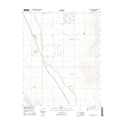
2014 Map of White Hills West
USGS Topo · Published 2014About this map
Triangle Airpark and the surrounding desert landscape of northwestern Arizona define this 2014 survey. Located near the intersection of Us-93 and W White Hills Rd, the airfield serves as a primary landmark in a region characterized by the arid expanse of the Mojave Desert. The map reveals a developing grid of residential and ranch roads, including aeronautically-themed names like Cessna Dr and Mooney Dr, alongside equestrian-inspired routes such as Palomino Dr and Saddleback Rd.
Find a feature on this map
42 named features on this map. Tap any name to fly to it.
Don’t see what you’re looking for? This feature index may not catch every label — zoom into the map to look around manually.
Map Details
Editions of this 2014 White Hills West Map
This is the sole edition of this map. No revisions or reprints were ever made.
Other maps of this area

1886 · Camp Mohave
USGS Topo · 1:250,000

1892 · Camp Mohave
USGS Topo · 1:250,000

1926 · Nelson
USGS Topo · 1:96,000

1942 · Camp Mohave
USGS Topo · 1:250,000

1947 · Kingman
USGS Topo · 1:250,000

1948 · Kingman
USGS Topo · 1:250,000

1954 · Kingman
USGS Topo · 1:250,000

1955 · Kingman
USGS Topo · 1:250,000

1958 · Kingman
USGS Topo · 1:250,000
1959 · Mt. Perkins
USGS Topo · 1:62,500