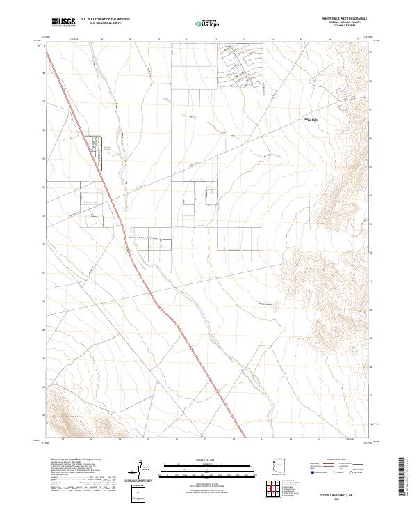
2021 Map of White Hills West
USGS Topo · Published 2021About this map
Detrital Valley and the Mojave Desert define this arid landscape, where contemporary infrastructure meets the rugged terrain of the Black Mountains. The settlement of White Hills is a focal point of activity, connected by a network of desert routes such as White Hills Rd and Co Hwy 145. A notable concentration of aviation-themed roads, including Cessna Dr and Mooney Dr, surrounds the Triangle Airpark, signaling the area's development around remote air access. Drainage through the basin is dominated by the Detrital Wash, which cuts across the valley floor. The map also highlights residential planning through uniquely named streets like Bonanza Dr, Saddleback Dr, and Silverspur Dr, reflecting the modern character of this Mohave County locale.
Find a feature on this map
39 named features on this map. Tap any name to fly to it.
Don’t see what you’re looking for? This feature index may not catch every label — zoom into the map to look around manually.
Map Details
Editions of this 2021 White Hills West Map
This is the sole edition of this map. No revisions or reprints were ever made.
Other maps of this area

1886 · Camp Mohave
USGS Topo · 1:250,000

1892 · Camp Mohave
USGS Topo · 1:250,000

1926 · Nelson
USGS Topo · 1:96,000

1942 · Camp Mohave
USGS Topo · 1:250,000

1947 · Kingman
USGS Topo · 1:250,000

1948 · Kingman
USGS Topo · 1:250,000

1954 · Kingman
USGS Topo · 1:250,000

1955 · Kingman
USGS Topo · 1:250,000

1958 · Kingman
USGS Topo · 1:250,000
1959 · Mt. Perkins
USGS Topo · 1:62,500