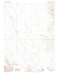
1989 Map of White Hills West
USGS Topo · Published 1990About this map
White Hills and its surrounding mining district define this desert landscape, characterized by a high concentration of hard-rock claims and early industrial activity. The area is dominated by several significant operations, including the Grand Army of the Republic Mine, Prince Albert Mine, and the Bonanza Mine. These sites, along with numerous adits and prospects, illustrate the intense mineral exploration that drew settlers to this arid part of the Detrital Valley.
Find a feature on this map
38 named features on this map. Tap any name to fly to it.
Don’t see what you’re looking for? This feature index may not catch every label — zoom into the map to look around manually.
Map Details
Editions of this 1989 White Hills West Map
This is the sole edition of this map. No revisions or reprints were ever made.
Other maps of this area

1886 · Camp Mohave
USGS Topo · 1:250,000

1892 · Camp Mohave
USGS Topo · 1:250,000

1926 · Nelson
USGS Topo · 1:96,000

1942 · Camp Mohave
USGS Topo · 1:250,000

1947 · Kingman
USGS Topo · 1:250,000

1948 · Kingman
USGS Topo · 1:250,000

1954 · Kingman
USGS Topo · 1:250,000

1955 · Kingman
USGS Topo · 1:250,000

1958 · Kingman
USGS Topo · 1:250,000
1959 · Mt. Perkins
USGS Topo · 1:62,500