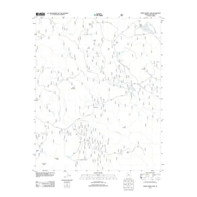
2012 Map of White Horse Lake
USGS Topo · Published 2012About this map
White Horse Lake and the surrounding high-elevation terrain of Coconino County are defined by a complex network of forest service roads and water management features. In this 2012 snapshot, the landscape is dotted with livestock tanks and small basins such as Saginaw Tank, Bar Cross Tank, and JD Dam Lake, reflecting the region's reliance on managed water sources. The topography is marked by distinct volcanic and sedimentary landmarks, including White Horse Knoll, Ruin Mountain, and the broad expanse of Cobble Flat.
Find a feature on this map
63 named features on this map. Tap any name to fly to it.
Don’t see what you’re looking for? This feature index may not catch every label — zoom into the map to look around manually.
Map Details
Editions of this 2012 White Horse Lake Map
This is the sole edition of this map. No revisions or reprints were ever made.
Other maps of this area

1886 · San Francisco Mtns
USGS Topo · 1:250,000

1886 · Chino
USGS Topo · 1:250,000

1887 · Verde
USGS Topo · 1:250,000

1887 · Prescott
USGS Topo · 1:250,000

1891 · San Francisco Mtns
USGS Topo · 1:250,000

1891 · Chino
USGS Topo · 1:250,000

1892 · Verde
USGS Topo · 1:250,000

1892 · Prescott
USGS Topo · 1:250,000

1894 · San Francisco Mtns
USGS Topo · 1:250,000

1899 · San Francisco Mtns
USGS Topo · 1:250,000