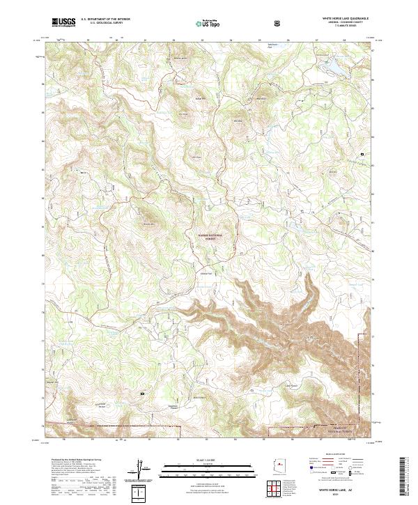
2021 Map of White Horse Lake
USGS Topo · Published 2021About this map
Kaibab National Forest and Prescott National Forest converge on this sheet, defining a high-altitude landscape where water management was essential to ranching or forestry. The terrain is marked by numerous man-made tanks, such as Sawlog Tank, Elk Tank, and Saginaw Tank, which served as vital collection points across the drainage basins of Lee Canyon and Tule Canyon. The network of travel includes several decommissioned routes like Old 127 Rd and Old 125 Rd, which intersect with newer recreational paths like the Sunflower Flat Mtn Bike Trl. Prominent landmarks such as Ruin Mountain and White Horse Knoll overlook the flats, while permanent water sources like Holloway Spring and Hitt Spring provide natural focal points in an area otherwise dominated by seasonal washes and strategic reservoirs like JD Dam Lake.
Find a feature on this map
73 named features on this map. Tap any name to fly to it.
Don’t see what you’re looking for? This feature index may not catch every label — zoom into the map to look around manually.
Map Details
Editions of this 2021 White Horse Lake Map
This is the sole edition of this map. No revisions or reprints were ever made.
Other maps of this area

1886 · San Francisco Mtns
USGS Topo · 1:250,000

1886 · Chino
USGS Topo · 1:250,000

1887 · Verde
USGS Topo · 1:250,000

1887 · Prescott
USGS Topo · 1:250,000

1891 · San Francisco Mtns
USGS Topo · 1:250,000

1891 · Chino
USGS Topo · 1:250,000

1892 · Verde
USGS Topo · 1:250,000

1892 · Prescott
USGS Topo · 1:250,000

1894 · San Francisco Mtns
USGS Topo · 1:250,000

1899 · San Francisco Mtns
USGS Topo · 1:250,000