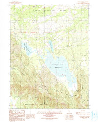
1990 Map of White Horse
USGS Topo · Published 1990About this map
The Whitehorse Flat Reservoir and the smaller Barnum Flat Reservoir dominate this high-country landscape on the border of Modoc Co and Siskiyou Co. In the late 20th century, this area of the Modoc National Forest shows a transition from active water management to forest resource extraction, evidenced by several Old Railroad Grades winding through the timber. The small settlement of White Horse sits on the eastern shore of the main reservoir, serving as a focal point for the region's cattle-ranching and logging history. Steep terrain rises sharply to the south and east with the Whitehorse Mountains and Big Valley Mountains. Grounded in the landscape are essential water sources for livestock and wildlife, including Bowman Spring, Whipple Springs, and the seasonal Wet Weather Lake, while unique landmarks like Hole In Rock provide navigation points in the dense forest.
Find a feature on this map
22 named features on this map. Tap any name to fly to it.
Don’t see what you’re looking for? This feature index may not catch every label — zoom into the map to look around manually.
Map Details
Editions of this 1990 White Horse Map
This is the sole edition of this map. No revisions or reprints were ever made.
Other maps of this area

1886 · Modoc Lava Bed
USGS Topo · 1:250,000

1892 · Modoc Lava-Bed
USGS Topo · 1:250,000

1932 · Bartle
USGS Topo · 1:96,000

1939 · Bartle
USGS Topo · 1:125,000

1954 · Alturas
USGS Topo · 1:250,000

1958 · Alturas
USGS Topo · 1:250,000

1961 · Hambone
USGS Topo · 1:62,500

1961 · Pondosa
USGS Topo · 1:62,500

1961 · Fall River Mills
USGS Topo · 1:62,500

1962 · Alturas
USGS Topo · 1:250,000