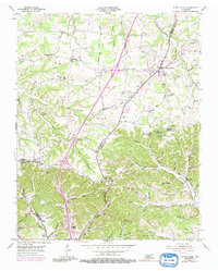
1954 Map of White House
USGS Topo · Published 1991About this map
White House and the surrounding borderlands of Robertson, Sumner, and Davidson counties are defined by a complex network of springs and family cemeteries in the mid-20th century. The landscape is deeply carved by drainage systems like Drakes Creek and Sulphur Fork Creek, with numerous mineral sources such as Black Sulphur Spring and Red Sulphur Spring indicating the area's natural hydrology. This era shows a transition in transportation, with the Blue Star Memorial Highway cutting a modern path through traditional farming communities.
Find a feature on this map
78 named features on this map. Tap any name to fly to it.
Don’t see what you’re looking for? This feature index may not catch every label — zoom into the map to look around manually.
Map Details
Editions of this 1954 White House Map
4 editions found
Other maps of this area

1903 · Nashville
USGS Topo · 1:125,000

1931 · Ridgetop
USGS Topo · 1:62,500

1935 · Ridgetop
USGS Topo · 1:62,500

1942 · Gallatin
USGS Topo · 1:100,000

1952 · Goodlettsville
USGS Topo · 1:24,000

1952 · Youngville
USGS Topo · 1:24,000

1952 · Hendersonville
USGS Topo · 1:24,000

1953 · Cottontown
USGS Topo · 1:24,000

1953 · Orlinda
USGS Topo · 1:24,000
1954 · White House
USGS Topo · 1:24,000