Loading...
Loading map...2022 Map of White Oak
USGS Topo · Published 2022About this map
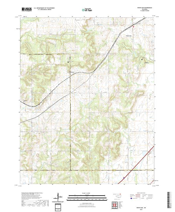
White Oak serves as a central hub in this modern Oklahoma landscape, where the prairie gives way to a network of creeks and small-scale water management. This 2022 survey documents a rural environment defined by sectional boundary roads and quiet settlements like Sunsweet and Catale. The eastern edge of the quadrangle reaches into Vinita, providing a look at the suburban fringes of the county seat.
Find a feature on this map
39 named features on this map. Tap any name to fly to it.
Don’t see what you’re looking for? This feature index may not catch every label — zoom into the map to look around manually.
Map Details
Date Portrayed2022
Date Published2022
PublisherU.S. Geological Survey
Map TypeTopographic
Scale1:24000
Physical Dimensions24 x 29 inches
Editions of this 2022 White Oak Map
This is the sole edition of this map. No revisions or reprints were ever made.
Historical Maps of Vinita Through Time
Featured Locations
Source Details
SourceU.S. Geological Survey
CopyrightPublic Domain