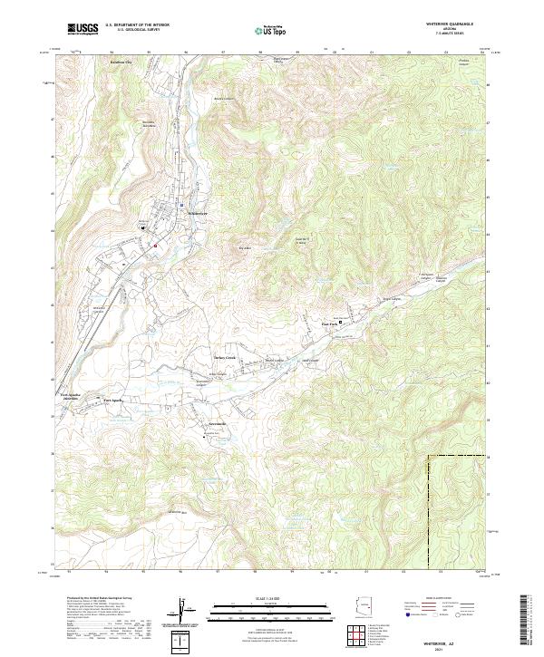
2021 Map of Whiteriver
USGS Topo · Published 2021About this map
Whiteriver serves as a central hub on this 2021 survey, situated along the North Fork White River and surrounded by high mesas like Nan Dahs Taan Mesa. The geography is defined by its water management and tribal communities, stretching from Rainbow City in the north down to the established grounds of Fort Apache and Fort Apache Junction. This modern record reveals a landscape where traditional life and infrastructure meet, featuring a dense network of local roads such as Chief Ave and One Step Beyond.
Find a feature on this map
91 named features on this map. Tap any name to fly to it.
Don’t see what you’re looking for? This feature index may not catch every label — zoom into the map to look around manually.
Map Details
Editions of this 2021 Whiteriver Map
This is the sole edition of this map. No revisions or reprints were ever made.
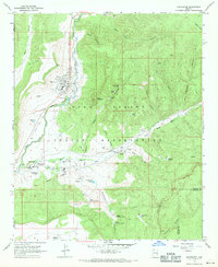
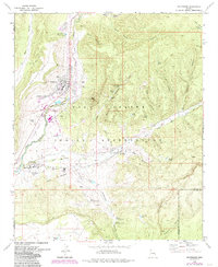
Historical Maps of Rainbow City Through Time
3 maps found