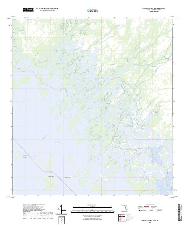
2024 Map of Whitewater Bay East
USGS Topo · Published 2024About this map
Marjory Stoneman Douglas Wilderness dominates this coastal wetland landscape, where a dense network of tidal rivers and bays defines the southwestern edge of The Everglades. The map traces several intricate backcountry routes, including the Everglades Paddling Trl and the Wilderness Waterway, which navigate through the complex hydrography of Watson River, North River, and Roberts River. These waterways converge toward larger open waters such as Whitewater Bay and Mud Bay. The absence of roads or permanent upland settlements emphasizes the primitive nature of this environment, with only the Midway Keys and Wedge Point providing small terrestrial landmarks amidst the mangrove-lined estuaries and sawgrass prairies. This area remains a critical interface between the freshwater drainage of the mainland and the saltier influences of the Gulf, connected by passages like Midway Pass and the Nomans River.
Find a feature on this map
18 named features on this map. Tap any name to fly to it.
Don’t see what you’re looking for? This feature index may not catch every label — zoom into the map to look around manually.
Map Details
Editions of this 2024 Whitewater Bay East Map
This is the sole edition of this map. No revisions or reprints were ever made.
Other maps of this area

1956 · Miami
USGS Topo · 1:250,000

1958 · Miami
USGS Topo · 1:250,000

1972 · Whitewater Bay West
USGS Topo · 1:24,000

1972 · Whitewater Bay East
USGS Topo · 1:24,000

1972 · Mahogany Hammock
USGS Topo · 1:24,000

1972 · Harney River
USGS Topo · 1:24,000

1972 · Lake Ingraham East
USGS Topo · 1:24,000

1972 · West Lake
USGS Topo · 1:24,000

1972 · Tarpon Bay
USGS Topo · 1:24,000

1972 · Pa Hay Okee Lookout Tower
USGS Topo · 1:24,000