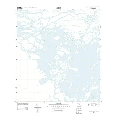
2012 Map of Whitewater Bay West
USGS Topo · Published 2012About this map
Shark River Island and the northern reaches of Cape Sable anchor this coastal survey, where the terrestrial landscape of Monroe County dissolves into a complex network of brackish channels and tidal bays. The geography is defined by the convergence of the Shark River and Little Shark River, which fracture the land into a mosaic of islands and peninsulas before emptying into Ponce De Leon Bay. The absence of roads or structures emphasizes the isolation of this environment, where water is the primary corridor for movement. Further south, the map details the transition into Oyster Bay and Whitewater Bay, connected by the narrow Cormorant Pass. The intricate branching of the Joe River near Mud Bay illustrates the fluid, shifting nature of this coastal wilderness as it appeared in the early 21st century.
Find a feature on this map
11 named features on this map. Tap any name to fly to it.
Don’t see what you’re looking for? This feature index may not catch every label — zoom into the map to look around manually.
Map Details
Editions of this 2012 Whitewater Bay West Map
This is the sole edition of this map. No revisions or reprints were ever made.
Other maps of this area

1956 · Miami
USGS Topo · 1:250,000

1958 · Miami
USGS Topo · 1:250,000

1972 · Whitewater Bay West
USGS Topo · 1:24,000

1972 · Whitewater Bay East
USGS Topo · 1:24,000

1972 · Harney River
USGS Topo · 1:24,000

1972 · Lake Ingraham East
USGS Topo · 1:24,000
1972 · Lake Ingraham West
USGS Topo · 1:24,000

1972 · Tarpon Bay
USGS Topo · 1:24,000

1972 · Shark River Island
USGS Topo · 1:24,000

1972 · Shark Point
USGS Topo · 1:24,000