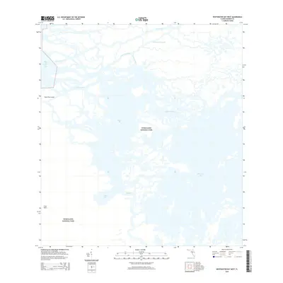
2015 Map of Whitewater Bay West
USGS Topo · Published 2015About this map
Everglades National Park covers this complex mosaic of mangrove islands and brackish waterways where the Florida peninsula meets the Gulf of Mexico. This coastal environment is defined by the constant movement of water through the Shark River and its various distributaries, including the Little Shark River and Shark Cutoff. These channels carve a path toward Ponce de Leon Bay, creating a labyrinthine shoreline of islands like Shark River Island.
Find a feature on this map
13 named features on this map. Tap any name to fly to it.
Don’t see what you’re looking for? This feature index may not catch every label — zoom into the map to look around manually.
Map Details
Editions of this 2015 Whitewater Bay West Map
This is the sole edition of this map. No revisions or reprints were ever made.
Other maps of this area

1956 · Miami
USGS Topo · 1:250,000

1958 · Miami
USGS Topo · 1:250,000

1972 · Whitewater Bay West
USGS Topo · 1:24,000

1972 · Whitewater Bay East
USGS Topo · 1:24,000

1972 · Harney River
USGS Topo · 1:24,000

1972 · Lake Ingraham East
USGS Topo · 1:24,000
1972 · Lake Ingraham West
USGS Topo · 1:24,000

1972 · Tarpon Bay
USGS Topo · 1:24,000

1972 · Shark River Island
USGS Topo · 1:24,000

1972 · Shark Point
USGS Topo · 1:24,000